St. Sever Cemetery Extension, Rouen
- Country France
- Total identified casualties 8674 Find these casualties
- Region Seine-Maritime
- Identified casualties from First & Second World War
- GPS Coordinates Latitude: 49.41263, Longitude: 1.06926
Location information
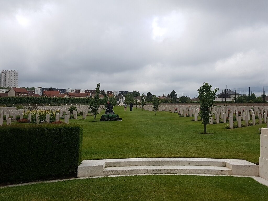
Both St Sever Cemetery and St Sever Cemetery Extension are located within a large communal cemetery situated on the eastern edge of the southern Rouen suburbs of Le Grand Quevilly and Le Petit Quevilly. Directions: As you near Rouen from the north, the A28 becomes the N28; stay on the dual carriageway and follow signs for N28 Rouen Centre. After exiting a tunnel follow directions to Le Mans and Elbeuf. After the road crosses a bridge, follow the sign for Sotteville St Sever. Continue straight on until you reach the 'Rond Point des Bruyeres' roundabout, next to the football stadium. Take the first exit into the Boulevard Stanislas Girardin. If approaching Rouen from the south, follow the D938 (Avenue des Canadiens) towards the centre of town. At the 'Rond Point des Bruyeres' roundabout, next to the football stadium, turn onto the Boulevard Stanislas Girardin. The cemetery parking and entrance is 180 metres down this road on the left. If arriving on foot, the easiest option is to take the Metro to the stop Charles De Gaulle in the Petit-Quevilly area and then walk east along the Boulevard Stanislas Girandin. If approaching Rouen from the south, follow the N138 (Avenue des Canadiens) towards the centre of town. At the 'Rond Point des Bruyeres' roundabout (next to the football stadium), take the fourth exit into the Boulevard Stanislas Girardin. The cemetery is 150 metres down this road on the left. If arriving on foot, the easiest option is to take the N°7 bus, which runs from Rouges Terres in the north of the city, through the centre (several stops, including the Hôtel de Ville), to Zénith Park Expo in the south. From the city centre, take the bus for Zénith Park Expo, alighting at the Rond-point des Bruyères (sports stadia). From the roundabout, walk WNW into Boulevard Stanislas Girardin. The cemetery entrance is 150 metres down this road on the left.
Visiting information
OPENING TIMES:
1 April - 1 November:
Monday-Friday 0830-1200 and 1400-1800
Saturdays, Sundays and Public Holidays: 0900 - 1830
2 November - 31 March:
Monday-Friday: 0830-1200 and 1400-1700
Saturdays, Sundays and Public Holidays: 0900 - 1730
History information
During the First World War, Commonwealth camps and hospitals were stationed on the southern outskirts of Rouen. A base supply depot and the 3rd Echelon of General Headquarters were also established in the city.
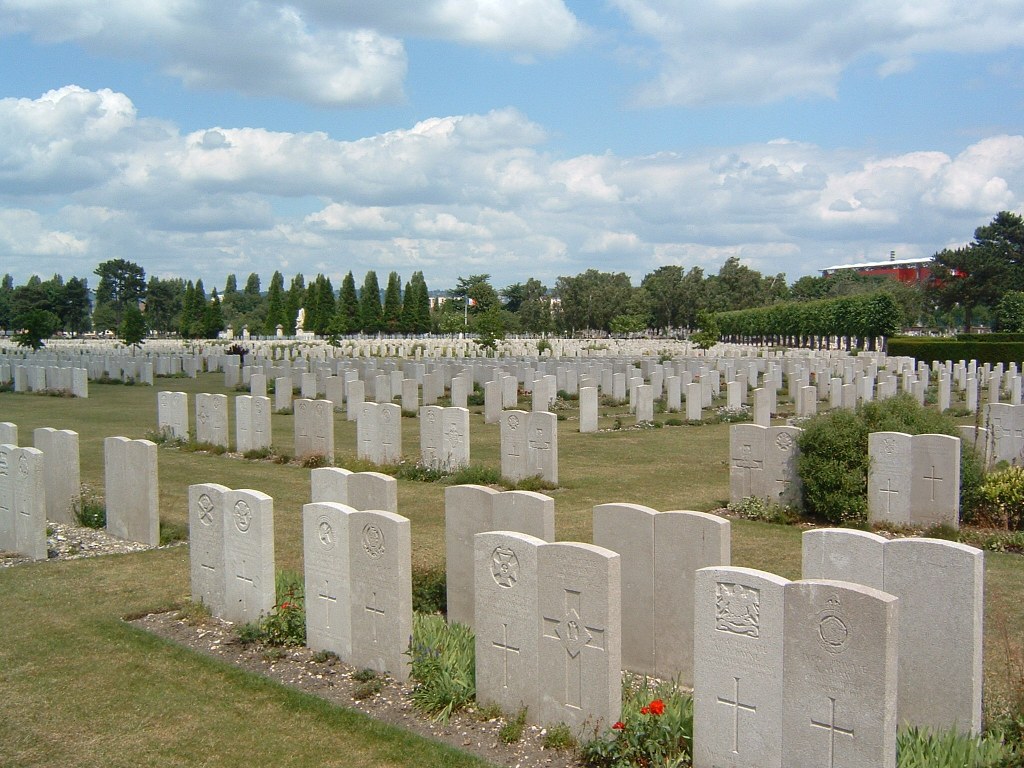
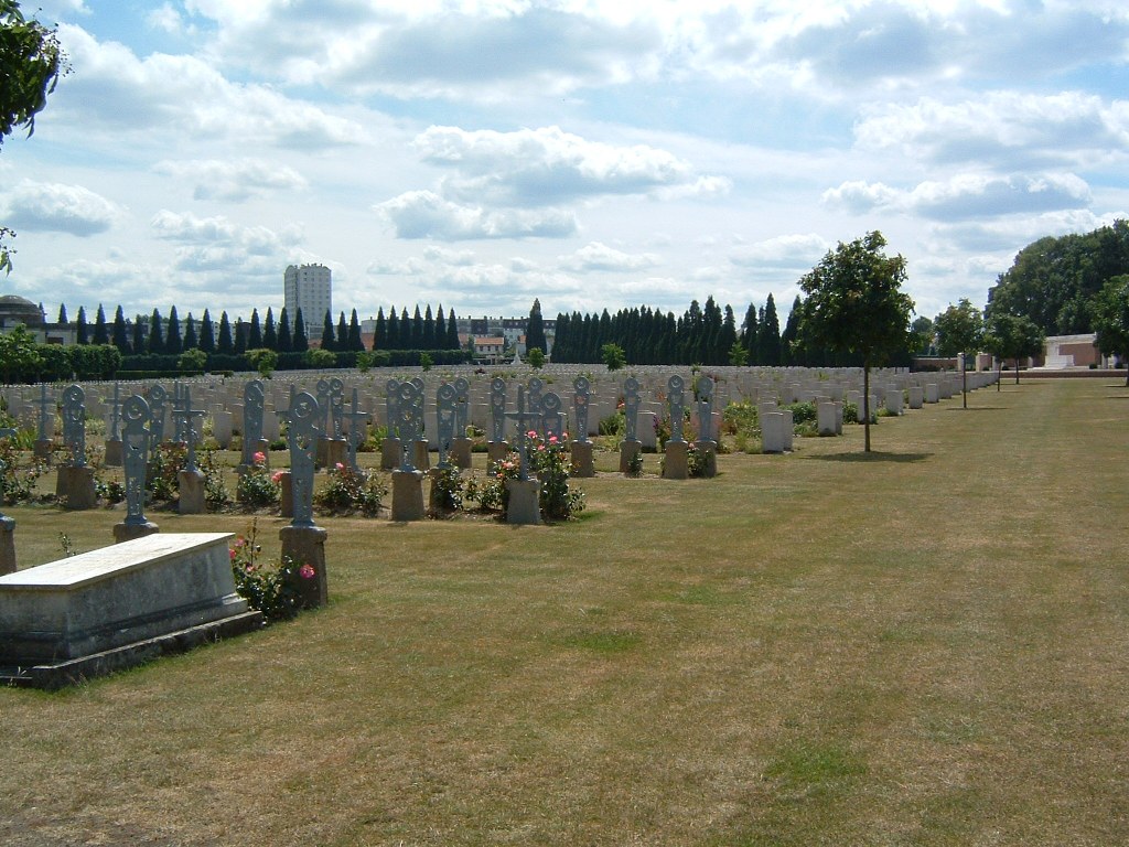
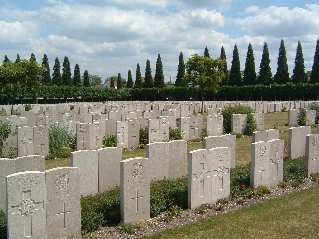
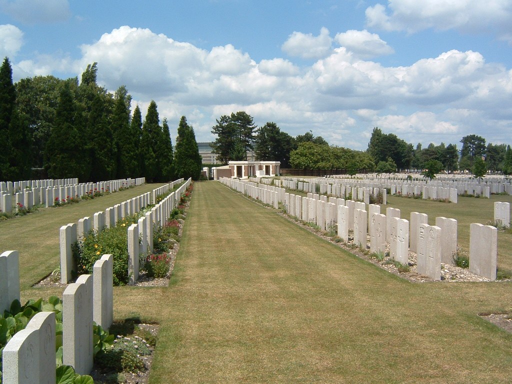
Almost all of the hospitals at Rouen remained there for practically the whole of the war. They included eight general, five stationary, one British Red Cross and one labour hospital, and No. 2 Convalescent Depot. A number of the dead from these hospitals were buried in other cemeteries, but the great majority were taken to the city cemetery of St. Sever. In September 1916, it was found necessary to begin an extension, where the last burial took place in April 1920.
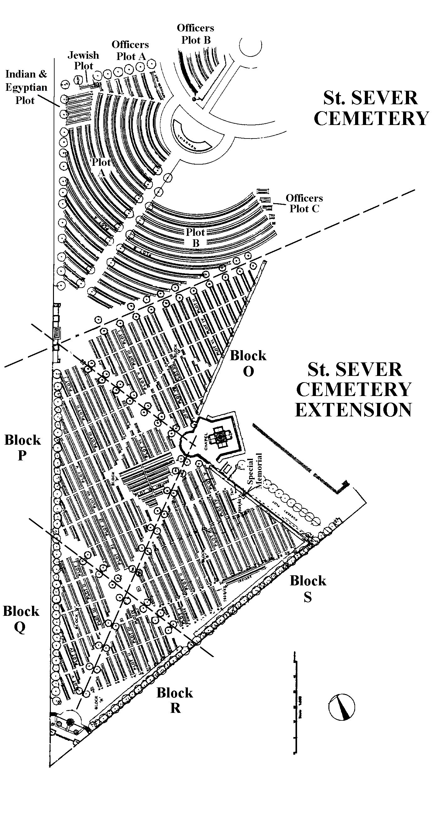
The Cemetery and the Extension adjoin each other but have separate Registers.
During the Second World War, Rouen was again a hospital centre and the extension was used once more for the burial of Commonwealth servicemen, many of whom died as prisoners of war during the German occupation.
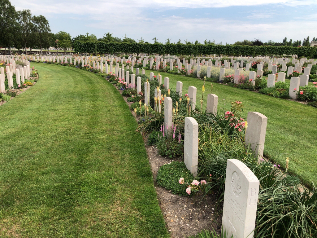
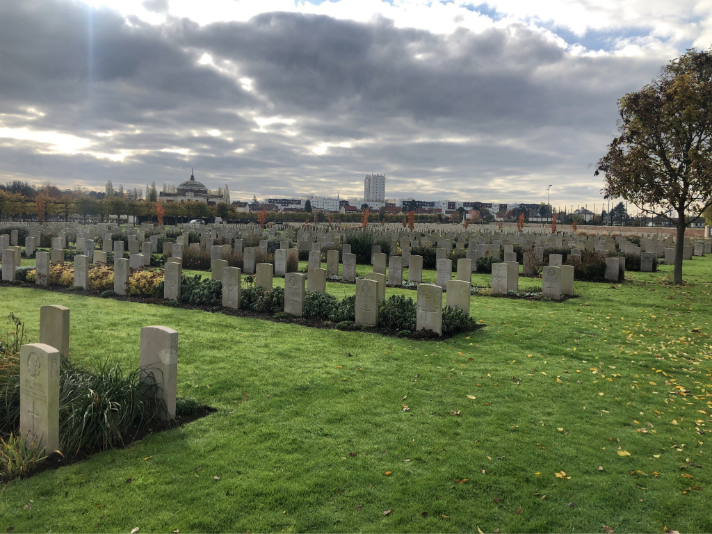
The cemetery extension contains 8,348 Commonwealth burials of the First World War (ten of them unidentified) and in Block "S" there are 328 from the Second World War (18 of them unidentified). There are also 8 Foreign National burials here. The adjoining St. Sever Cemetery contains 3,082 Commonwealth burials of the First World War. There is also 1 French burial and 1 non war service burial here.
The extension was designed by Sir Reginald Blomfield.